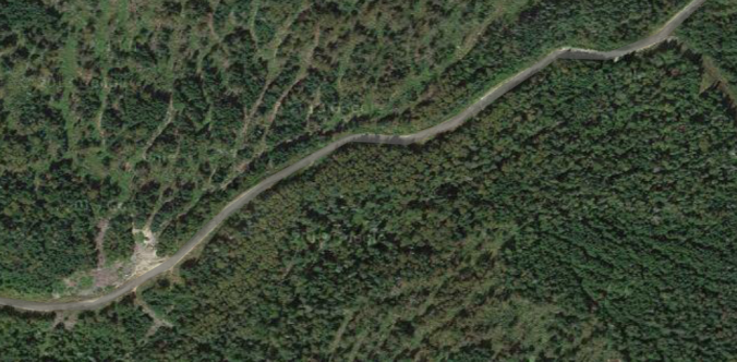
I will start this post by saying something I usually would not say about any of my trips: Do NOT Attempt, not if you like to spend most of your time actually riding your bike. This trip is a good example that even when you think you’ve done your planning, covered all your bases and have a good route picked out, the whole thing can still go to shit. And oh yeah, don’t trust what you think you see on Google Maps satellite images.
I’m not sure who I can blame, but I think it was my friend Jimmy who came up with the idea of doing a big gravel road bike ride from his camp in Kingfield last June. We studied maps and satellite imagery to come up with a plan. We would ride west from Kingfield and connect up with back roads to do an end-run around Mt. Abraham and place us in the southern end of Caribou Valley. From there it would be some adventurous gravel road riding due north, where we would eventually pop out between Crocker Mountain and Sugarloaf Mountain into Carrabassett Valley for the easy ride down the Narrow Gauge Trail back to Kingfield. The scenery was certain to be spectacular as there are big mountains on all sides. Total distance looked to be about 60 miles or so, perfect training for the bigger rides we had planned for later in the summer.
The day dawned clear and warm, so we were excited to get moving. After the quick descent into Kingfield we headed west. Soon enough, we came to our first obstacle: Rapid Stream. Luckily the stream wasn’t too rapid and we waded across easily. Here the road turned to dirt and it was quite pleasant cruising through the forest on our cyclocross bikes.
Continuing west, we kept our eyes peeled on Mt. Abraham looming directly north. We knew once we got a little past the mountain, we should be turning north. Sure enough, our turn showed up on schedule and we started climbing up the lower flanks of Abraham. The first sign of trouble came when the road turned into a rough logging path that had water and mud running down it. We soon ran into a gentleman who ran a one-man logging operation. Since the road didn’t look like it continued too much further, we asked him if he knew how we could proceed into Caribou Valley. He pointed to a nearby ATV trail and said we could get on track by taking it to the town of Barnjum. Now Barnjum sounded a little too much like “banjo” to me and I had never heard of it, but the guy looked like he’d spent some time in these woods—maybe too much time—so we heeded his advice.

Looks like a road, right?
The ATV trail was barely rideable but we slogged along and eventually came out to the north-south gravel road Jimmy and I had spied on satellite imagery. A quick check of his GPS confirmed this. As far as Barnjum goes, let’s just say it’s the only named town I’ve ever seen that has no people or structures of any kind.
With the proper route found, we thought we’d flash this ride quickly. The gravel road looked really solid on the satellite imagery, and seeing it in the flesh gave us a sense of confidence. Now it was time to really ride. Little did we know the real fun was just about to begin.
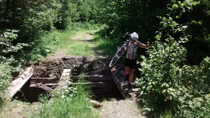
We made it a couple miles before the good road went right and our route went straight. The large tree placed as a barrier to vehicles gave us an inkling that maybe this route wasn’t all it was cracked up to be. The surface became progressively soft and overgrown as we pushed on. Then we came to a bridge, or I should say what was left of a bridge.

The bridge that almost wasn’t.
If this thing was any more dilapidated the trip would have ended right then and there. But we were able to tip-toe over the remaining beams without tumbling into the stream below. From here the road got worse and worse, with long unrideable sections. It was also ascending steadily and sometimes steeply. Eventually we couldn’t ride at all as the road slowly became a small stream with large cobbles and boulders. The forest was slowly reclaiming the road, in a few years it will probably be gone completely. Poor Jimmy was wearing road cycling shoes with protruding cleats, so walking in this quagmire was challenging for him to say the least.
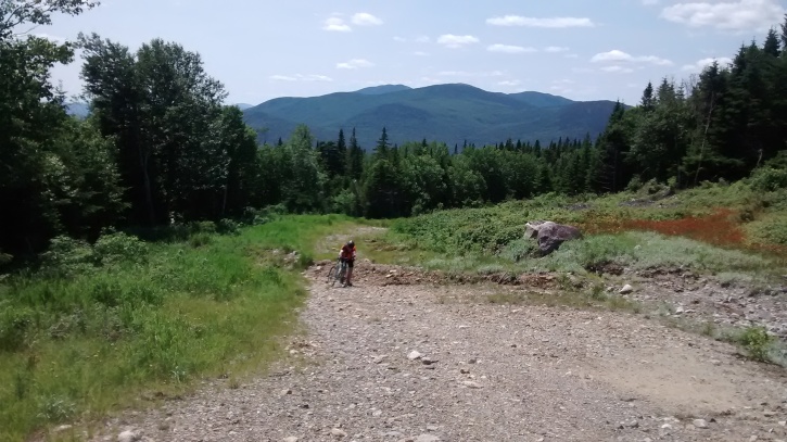
We stopped to take stock of the situation. It was mid-day and Jimmy’s GPS showed we were at an elevation slightly over 3,000 feet. Luckily the weather was perfect as we were clad in nothing but light cycling gear wearing CamelBaks with water and some snacks. The GPS showed we were a couple miles south of Caribou Pond. We were certain the road would get better from there as we knew people drove trucks into the pond to fish. The question was: could we get there from here?

Believe me, it’s steeper than it looks. Elevation 3,000 feet in the middle of nowhere.
Fortunately, we had topped out elevation-wise and the “road” began to descend. Unfortunately, the road also began to disappear. It was actually quite amazing. Grass, bushes and small trees were taking over the path. And since the former dirt road was a more permeable pathway than the surrounding terrain, a steady stream of water flowed down it. There were even small pools and waterfalls. I thought to myself “I swear this looked like a road on the satellite shots!”
It was nothing but hike-a-bike at this point. Poor Jimmy’s shoes were coming apart and I feared he would finish the ride in bare feet. We had duct tape so we could have lashed his feet to the pedals and he would be okay……as long as he didn’t have to stop.
Finally, as the slope bottomed out there were signs of improvement. Caribou Pond came into view on the left and the road started to reappear. After one sketchy bridge crossing we were back on a rideable dirt road. Soon we were on the harrowing descent down Caribou Pond Road to Route 27. Then we were back in Carrabassett Valley with the comforting view of Sugarloaf Mountain on our right.
My friend Eddie likes to say “nobody works harder at having fun than a bunch of men.” I always questioned this statement but not in this case. We probably hiked about 5 miles in uncomfortable cycling shoes—Jimmy’s went straight into the trash afterward—and worked far harder than expected. But what could have been a truly epic mess of a trip was actually fun, and the beers tasted oh-so-good when we were back sitting on Jimmy’s deck having a good laugh about the whole day.